Revision Date 5rd January 2026
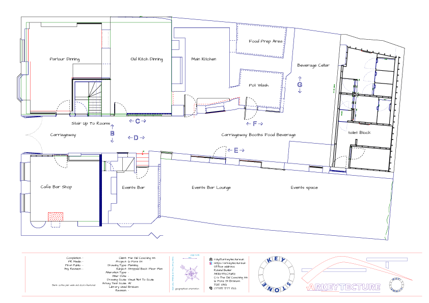
this is a demonstration of using layers within ARKEY C.A.D. software from just the walls / simple outline which has been used for pricing purposes and too for [ alcohol and pavement ] licencing and while surveying where the food prep area is had us all scratching our heads turns out it was a water tank that was closed of
But to finish one drawing for 1 project and not multiple drawings on paper as traditional Architects would use
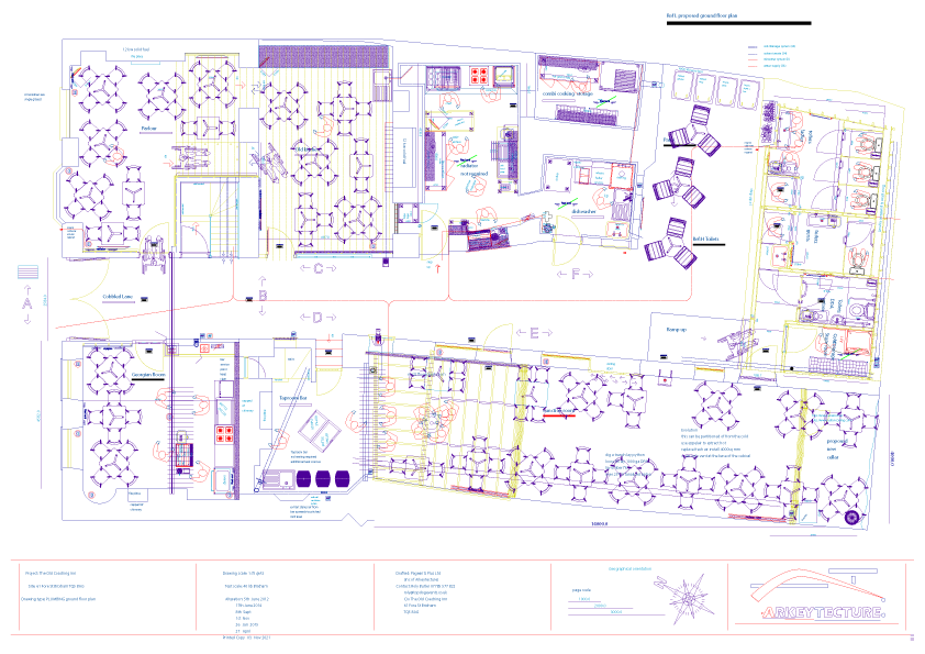
This type of drawing is also really helpful when calculating thermal R & U values etc & eg area and volume
almost a fully loaded ground floor plan Most pipework and electrics are still missing and would be a total mess
One can have up to 120 layers to overlay say General Electrics Fire alarm & extinguishers emergency lighting Plumbing hot & cold supplies heating flow & return Floor covering Furniture all Cater equipment in 1 drawing
All one has to do is create an index and switch it on or of each layer within the same drawing Quite often the different trades don’t talk to each-other and that’s 1 place where mistakes can be made! and they don’t normally care who is coming behind them / following on from
We can create floor plan/s like the 1 to the left
a simple survey measure and draw for local Estate Agents Landlords etc perimeter square area volume
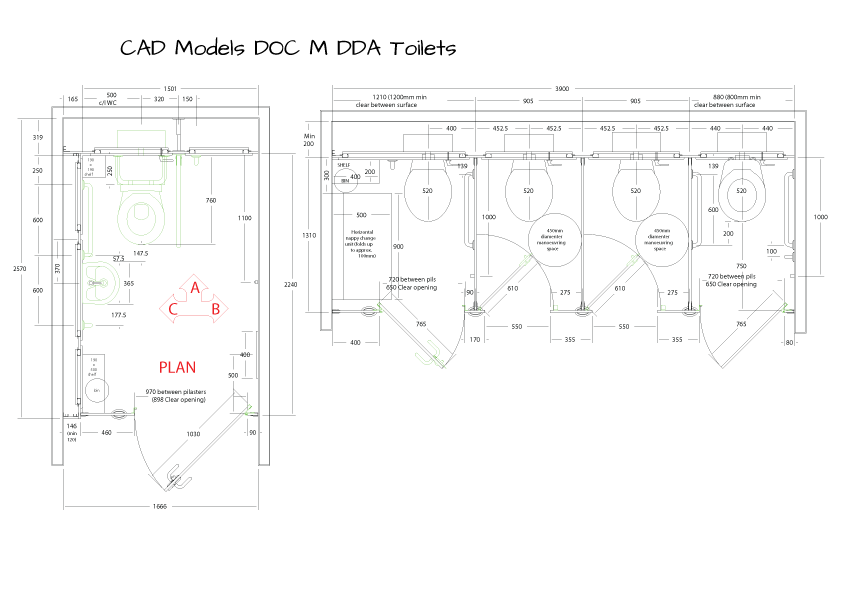
Armitage Shanks .dxf drawing Doc M pack
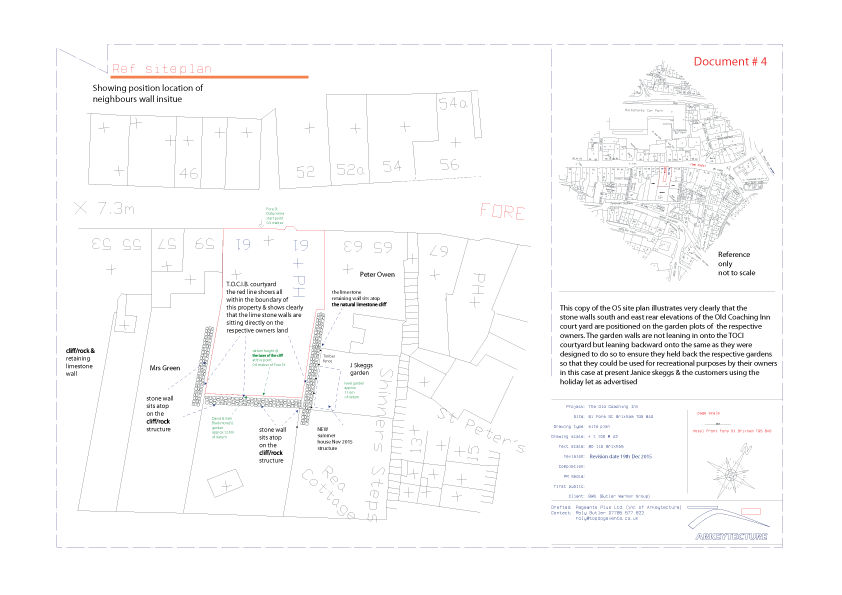
The pub project O.S. Ordnance Survey plan view position geographical and orientation PLANFOOT PRINT
End of Plan 2 webpage
Home Joinery 3D Models Elevation Plan 2 Structural Likes About W.D.I.T.O.T.